
Sell development land in Darras Hall
Whether your land is in Darras Hall itself or in the villages between Darras Hall and Ponteland, we'll look at it properly before making any offer.
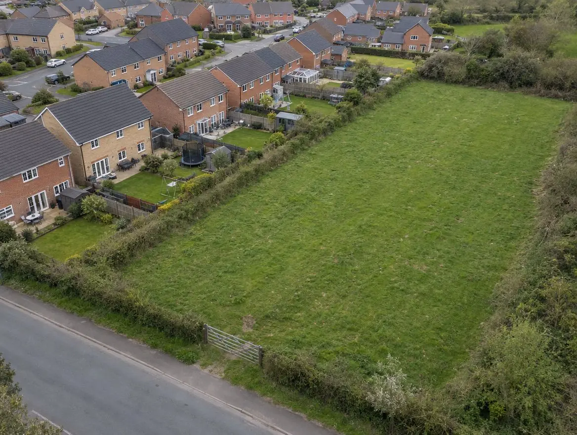
Most development land starts life as an ordinary field. What makes it valuable is where it sits: next to existing homes, close to a road, inside or near a settlement boundary. We assess those things first and give you a straight answer.
- Free appraisal and written offer
- No commission: we're the buyer
- Independent advice encouraged
Selling land near Darras Hall?
Send the postcode and a rough size.
Land around Darras Hall
Land around Darras Hall falls under England's planning system. The closest towns we also cover are Ponteland, 1 mile away, and Newburn, 3 miles away, and Blyth is 12 miles away.
Sparsely populated, with Northumberland National Park, the Northumberland Coast National Landscape, and green belt around the south-east towns near Tyneside.
| Town | Darras Hall |
|---|---|
| County | Northumberland |
| Country | England |
| Postcode district | NE20 |
| OS grid square | NZ17 |
| Nearest towns we cover | Ponteland (1 mi), Newburn (3 mi), Prudhoe (6 mi) |
| Distance from Blyth | About 12 miles south-west |
| Planning system | National Planning Policy Framework and local plan |
| Ways to sell | Outright, subject to planning, option or joint venture |
What we look for around Darras Hall
- Land that adjoins an existing town, village or housing estate
- Sites from around a quarter of an acre upwards
- Land outside the highest-risk flood zones, or where flood risk can be designed out
- Land with a planning history we can build on, even if earlier applications were refused
Selling development land well depends on matching the deal to the planning position. With permission in place, an outright sale is usually simplest. Without it, a conditional contract or option can share the planning risk fairly.
What decides the value of development land near Darras Hall
Planning status
Land with an implementable permission is worth far more than land with none, because the biggest risk has gone.
Ground and drainage
Poor ground, contamination or the need for a pumping station all add build cost that comes off the land price.
Local sale values
The price new homes will sell for nearby sets the ceiling on what the land is worth.
Ecology and trees
Protected species, ancient hedgerows and tree preservation orders can reduce the developable area.
Choosing how to sell
Outright purchase
Best where permission is already granted and the title is clean.
Subject-to-planning sale
Lets you lock in a price now that is paid once we secure permission.
Option agreements
Suits larger fields where the planning route may take several years.
Joint ventures
Worth discussing if you want a share of the finished development value.
How a sale works
Tell us about your land
Send the postcode or address and a rough size.
We check it properly
Title, planning history, access, flood maps and local policy.
You get a written offer
With the main figures behind it, so your adviser can check it.
The legal work
Your solicitor and ours handle the contract through to completion.
Rules that apply in England
Planning framework
Planning decisions in England follow the National Planning Policy Framework, revised in August 2026, and the local plan, prepared by the council or, in a national park, the park authority. Plans are reviewed periodically, which is when new housing sites are usually allocated.
Green belt and grey belt
Green belt land is protected from inappropriate development. National policy in England also recognises 'grey belt': green belt land that doesn't strongly contribute to key green belt purposes, where housing can be acceptable if further tests are met.
Flood risk
Environment Agency flood maps and the sequential test steer new homes away from areas at highest risk of flooding.
When the land isn't straightforward
The site has been refused planning before
A refusal tells us what the council objected to. We read the decision notice and judge whether a different scheme could answer it.
Part of the field floods
We map the flood zones and look at whether homes can sit on the drier part, with the rest used as open space.
Useful to send us
- A rough size, in acres or hectares
- Your title number, if you know it
- Photos of the land and its access
- How soon you'd ideally like to sell
Your questions answered
How do I know if my land is development land?
Ask three questions: does it sit next to existing homes, can a car get onto it safely from a public road, and is it outside the worst flood risk? If the answer to all three is yes, it is worth an appraisal. We will tell you honestly if we don't think homes are achievable.
Will I pay any fees to you?
No. We are the buyer, not an agent, so there is no commission. You will normally pay your own solicitor unless we agree otherwise in writing.
Should I get my own valuation?
We recommend it. An independent RICS valuer or land agent can tell you whether our offer is fair, and you are under no obligation to accept.
Do you buy land in Darras Hall?
Yes. We consider land in and around Darras Hall and across Northumberland. Whether we can make an offer depends on the land itself, especially its access and planning prospects, and we'll tell you either way.
Other land types and routes
- Land with planning permission
- Land without planning permission
- Large strategic sites
- Green belt and grey belt land
- Land for affordable homes
- Farmland and agricultural land
- Paddocks and equestrian land
- Barns and rural buildings
- Building plots
- Garden land and backland
- Infill plots and gap sites
- Small sites
- Garage sites
- Brownfield land
- Redundant commercial and industrial land
- Inherited and probate land
- Landlocked land and access problems
- Outright purchase
- Subject-to-planning sale
- Option agreements
- Joint ventures
- All land in Darras Hall
- Development land in Northumberland
Find out what we'd pay for your land near Darras Hall
A free appraisal tells you what we'd pay and why.